News
Kenyan Farmers Are Using Drones for Agriculture – Here’s How
When drone pilot Ken Mbuki met Michel Iland at a Kenya Drone Business Competition, they realised they had something in common: both needed and used drones to improve their farming operations.
Mbuki, a business intelligence specialist at Moringa School in Nairobi, was introduced to farming by his mother early in life. Despite his high-end career and city life, farming remained a passion.
Today, Mbuki, like so many middle-class “Nairobians”, actively farms a piece of land that he owns upcountry. He precision farms two acres in Kitui, a town east of Nairobi.
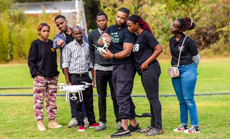
Global Air Drone Academy CEO Enoh Umoh (third from left) offering technical guidance to Ken Mbuki (third from right in striped shirt) and his counterparts. Photo: Lucy Githugo, bird story agency
Back in Nairobi, when not immersed in cost-cutting strategies or trying to explore innovative opportunities for Moringa School, Mbuki can also be found at KCA University giving lectures on object-oriented technologies. He leads a multifaceted life, juggling numerous roles and responsibilities, making time a precious commodity. When it comes to farming, he expects to be able to apply the same principles that guide his life, capitalising on data-driven insights to determine the optimum amount of water, fertilisers, and pesticides for application on his farm. His answer? A drone.
“I would hire at least four people to come spray insecticides on my farm, and they would work continuously from 8 a.m. until 5 p.m. to finish the two acres. In the long run, I would still find that some patches were ignored. But now, with a drone, I only use one hour to accurately spray the whole farm,” Mbuki said, explaining how he has moved his farming operation to precision agriculture.
Precision agriculture is a type of farming that uses technology to optimise crop production and involves using a range of tools, such as GPS, sensors, and drones, to gather data about the farm and the crops being grown.
The change, in terms of time, money, and efficiency, has been transformational for Mbuki. That transformation is echoed by Iland, who has chosen precision agriculture to further develop his 170-acre piece of land in Mau-Narok.
“The biggest challenge I had when using tractors with GPS was the tractors stepping on wheat in the initial stages. That was damaging, and it meant a reduction in the yield. But drones have reduced this drastically by around 40%,” said Iland.
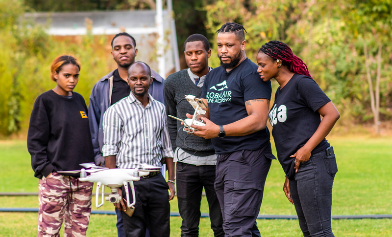
Global Air Drone Academy CEO Enoh Umoh (second from left) offering technical guidance to Ken Mbuki (third from right in striped shirt) and his counterparts. Photo: Lucy Githugo, bird story agency
And yet, when wanting to upgrade to the new technology, both men faced the same challenge: obtaining approval from the Kenya Civil Aviation Authority (KCAA).
“A person shall not conduct an Unmanned Aircraft System flight commencing at a place outside Kenya and terminating at a place within Kenya or over-flying the Kenyan airspace without authorization from the Authority,” reads a section of KCAA’s 2020 regulations.
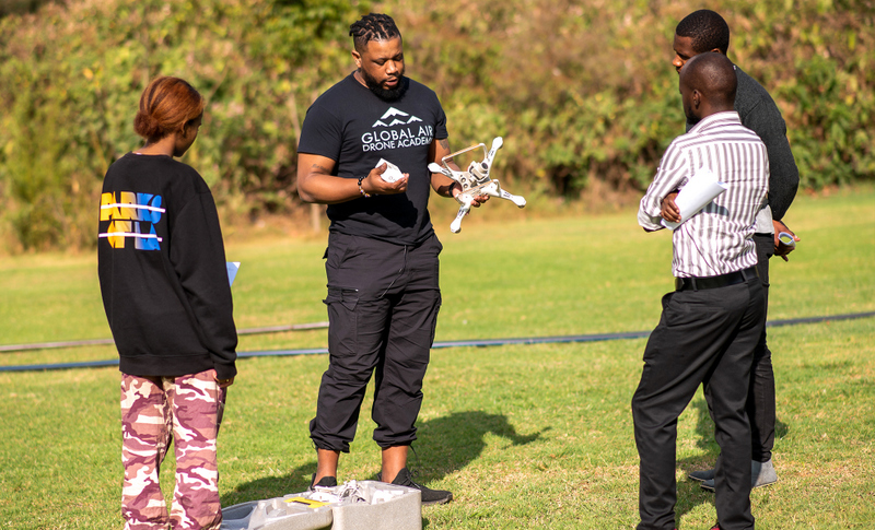
Global Air Drone Academy CEO Enoh Umoh (holding drobe) offering technical guidance to Ken Mbuki (furthest left in stripped shirt) and his counterparts. Photo: Lucy Githugo, bird story agency
After three weeks of persistent effort, guided by the regulations, even after officials undertook the 161-kilometre journey from Nairobi for a farm visit, the Authority refused to grant Mbuki the permission he needed to farm with a drone.
Efforts by the author of this article to reach KCAA officials for comment were futile as most officials did not want to comment on this specific matter, with one explaining that “the matter of drone usage in farming is still a new concept.”
For Mbuki, struggles like this one, faced by a new generation of “smart farmers,” are at odds with calls by African governments for the farming revolution required to feed fast-growing populations and for Africa to be self-sustaining.
In a four-month growing season, farmers in Kitui need to spray their crops at least once a week, but the bureaucratic hurdles on the use of drones obstruct this critical aspect of precision farming.
Kitui County Senior ICT Officer Tabitha Kimanthi admitted that Mbuki was the first farmer in the area to approach the county government with “this daring and technical approach to farming”.
“Kitui is not used to seeing drones, even for other uses other than precision farming. This is a fascinating idea, and as a government, we have to think along these lines. For now, since it is a new thing, we are trying to have a sit-down that will come up with a structured way of handling smart farming,” Kimanthi said.
Drones create detailed maps of crops due to their aerial capability in crop mapping. The images captured by drones and looking at vegetation cover are taken by a multi-spectral sensor using what’s called soil and vegetation indices.
From the image, one can analyse the different information about the indices. Whether it is the soil index or vegetation index, one can determine the moisture content in the soil or identify stress factors that could affect the productivity of a certain crop in that soil.
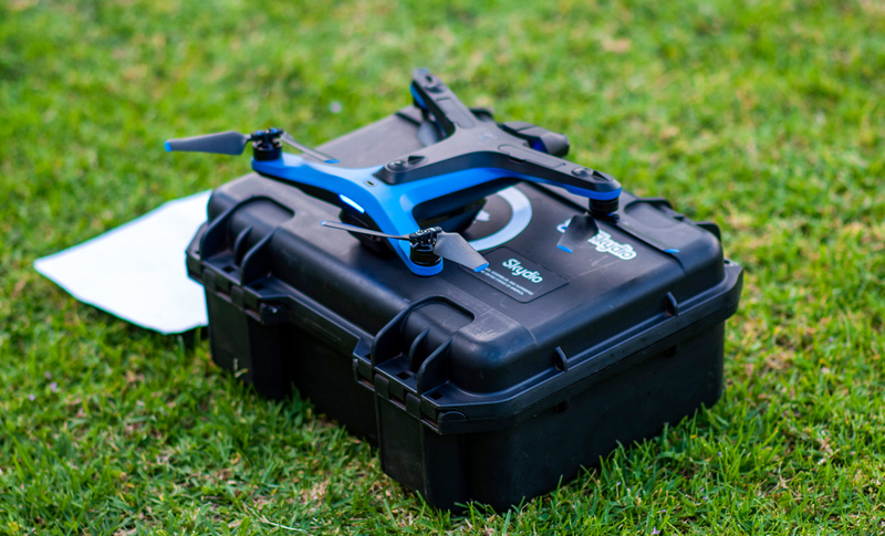
A MAVIC 3 Drone kit which comes with a drone, batteries, controller, charger and propellers. Photo: Lucy Githugo, bird story agency
According to the Global Precision Farming and Agriculture Market (2023–2029) Research Report Analysis and Outlook Insights, the industry is experiencing substantial growth worldwide.
Today, Mbuki is a qualified drone pilot and is sharing his knowledge and skills with other farmers, like Iland. For his part, Iland hires drone pilots to help him with his farm management.
Iland is particularly fascinated by the fact that drones could revolutionize rice farming in Kenya, saying the pouring of rice seedlings into water has proved to be a tedious and messy affair for farmers in rice-growing areas over the years.
For Iland, who mainly grows wheat and potatoes, the use of drones on his farm has not only increased yields but also considerably reduced crop damage caused by tractors, other land-based vehicles, and people.
He, too, is now learning to fly his drones and plans to offer drone agriculture services to other farmers in the region.
Story Credit: Lucy Githugo for Bird Story Agency

